Answers to Questions about the World Grid
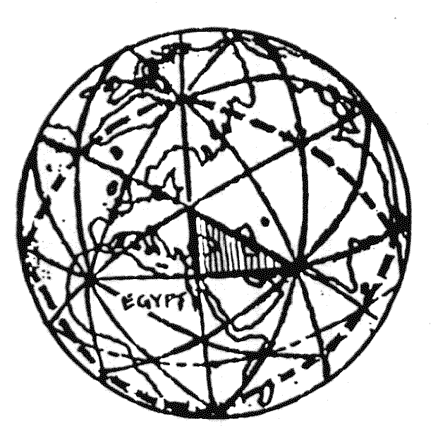
- Is there a typology of grid lines, i.e., do the edges of different solids (or the three additional sets of great circles proposed by R. Buckminster Fuller) manifest different characteristic properties?
- Are there characteristics associated with the three "major" types of grid intersection (12 centers of dodecahedron faces; 20 centers of icosahedron faces; and 30 "diamond" centers where dodecahedron and icosahedron edges cross)?
- What counts as "on" a grid line?
- Is human energy part of the grid system?
- Can/ should the grid be publicly discussed as a planning model for global environmental/ technological cooperation?
- Is the concept of the grid useful as a mnemonic model that will empower individuals who have learned about it?
These have not been easy to answer, especially since it is so easy to be self-serving in this regard. Here is our thinking at the present time.
(1) Tentatively, we believe "yes". The Greeks assigned meanings to each of the solids which make up the grid (tetrahedron = fire; cube = earth; octahedron = air; icosahedron = water; and dodecahedron = life), and we believe that these meanings may have been assigned in conjunction with real geometry (earthmeasuring). A few examples: dodecahedron edges form the midAtlantic ridge, a site which scientists are currently studying in view of emerging life forms that do not depend upon light energy in the usual sense; most icosahedron corners which are in water are centers of ocean currents; octahedron edges form the entire system of 120 UVG basic triangles; the richest agricultural and oil producing region in Canada is at Point 8--an intersection of life, air, fire, and earth edges as well as great circles proposed by Fuller.
(2) We believe "yes" on this question also. At least in the places we have been able to document, centers of dodecahedron faces (a.k.a. Ivan Sanderson's vile vortices) do seem to be associated with so-called time warps and magnetic anomalies. We have labeled them "subduction zones" somewhat intuitively feeling that they suck energy -- perhaps even human emotional energy.
We have labeled areas such as Point 8 in Alberta and Point 2 near Chernobyl "expansion" zones. These areas appear to be us to be bountiful in either food, minerals, or other energies needed by life-forms. (These are centers of icosahedron faces.)
Finally, we think of the dodecahedron/icosahedron edge intersections (UVG diamond centers) as communication zones--with high potential for spiritual interaction. Areas such as Point 1 at the Great Pyramid, Point 11 in northern Scotland, Point 17 in northern Mexico are among the few we have studied in any depth. We actually visited Point 17 and discovered an enormous array of satellite and other communications dishes and antennae. Within the past year, the Australian Monash Review reported the discovery of a huge electrical anomaly near Point 44--a diamond center. The following is-s quoted directly from Science Frontiers, published by William Corliss (Box 107, Glen Arm, Illinois) 21057):
"Geophysicists from the Department of Earth Sciences and the Bureau of Mineral Resources have discovered part of a huge underground circuit near Broken Hill... which contains electrical currents of more than a million amps...
The circuit was found using a sensor which detects fluctuating fields in the earth's crust. These are created in response to electrical events, such as thunderstorms and the movement of dissolved salts in artesian water." We feel that there is the potential for grid testing using this method. In addition, we would like to pass on the invitation below to subscribe to The Ley Hunter. Editor Paul Devereux has been systematically testing sacred sites in Great Britain and discovered the presence of uranium at virtually all of them. Given the uranium located in the vicinity of Point 17, this may be another property that is associated with UVG diamond centers.
EARTH MYSTERIES is the term for the holistic, or systems, approach to the study of ancient places their landscapes, their geomancy (sacred geography: e.g., leys), their astronomy and their energy secrets.
THE DRAGON PROJECT is the Centre's energy research program at ancient places. Specific geophysical char3ctL-ristics are being discovered at certain sacred sites, and possible mind/body interactions.
(3) The grid lines for- the United States shown on the following page are approximately 10 miles in width. We generally classify items as "on" if they fall within 5 miles of these lines. (We have gone a step further and put 2-mile-wide grid lines in a Rand-McNally Road Atlas of the United States. By plotting specific items on this map, we are able to see "lines" of events/geophysieal items begin to manifest. Sometimes these are "off" the Atlas lines by ten miles or so, but they will form a line parallel to the marked grid line. We are hopeful of eventually getting the UVG sphere on to a global computer modeling system so that we can shift it. So far we have been unable to do this.)
We generally give a range of 50 - 100 miles in any direction of one of the major 62 grid intersections--and call it "on".
[CONTINUES]
Daniel Evan Shaw, website copyright © 2024